
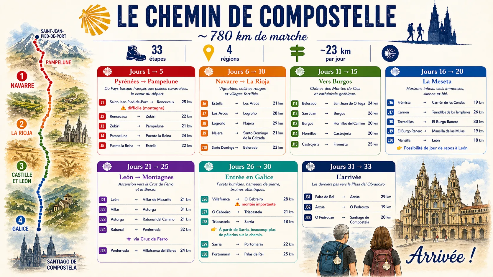
790 km · about 35 days
Our Camino Francés itinerary
From Saint-Jean-Pied-de-Port to Santiago, we will move at our own pace. Each evening, the live map and journal will show our actual location.
- Saint-Jean-Pied-de-Port → PamplonaPyrenees · 68 km
- Pamplona → LogroñoNavarre and Rioja · 95 km
- Logroño → BurgosVineyards and high plateaus · 121 km
- Burgos → LeónCrossing the Meseta · 179 km
- León → PonferradaLeón Mountains · 103 km
- Ponferrada → SarriaEntering Galicia · 91 km
- Sarria → SantiagoFinal 115 km
Distances are approximate. Actual stages may change depending on weather, fatigue and encounters along the way.
See live progress